Vermont State Maps
How have Vermont towns and counties changed over time?
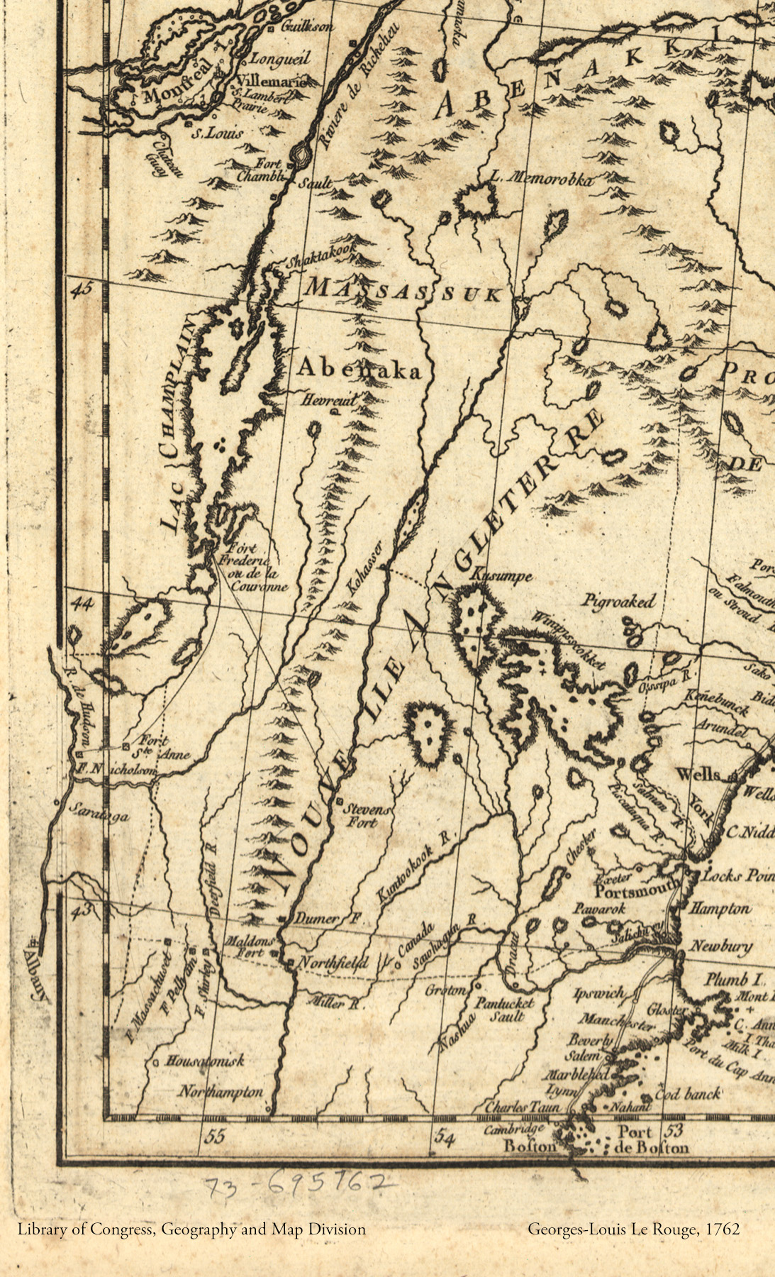
1762 New England map, Georges-Louis Le Rouge
This corner of a map of Canada includes New England (or nouvelle angleterre in French). The land that becomes Vermont is east of Lac (or Lake) Champlain. What evidence does the map show of the native people who lived on the land?
Explore More: The Abenaki & the Europeans
See the entire map at the Library of Congress.
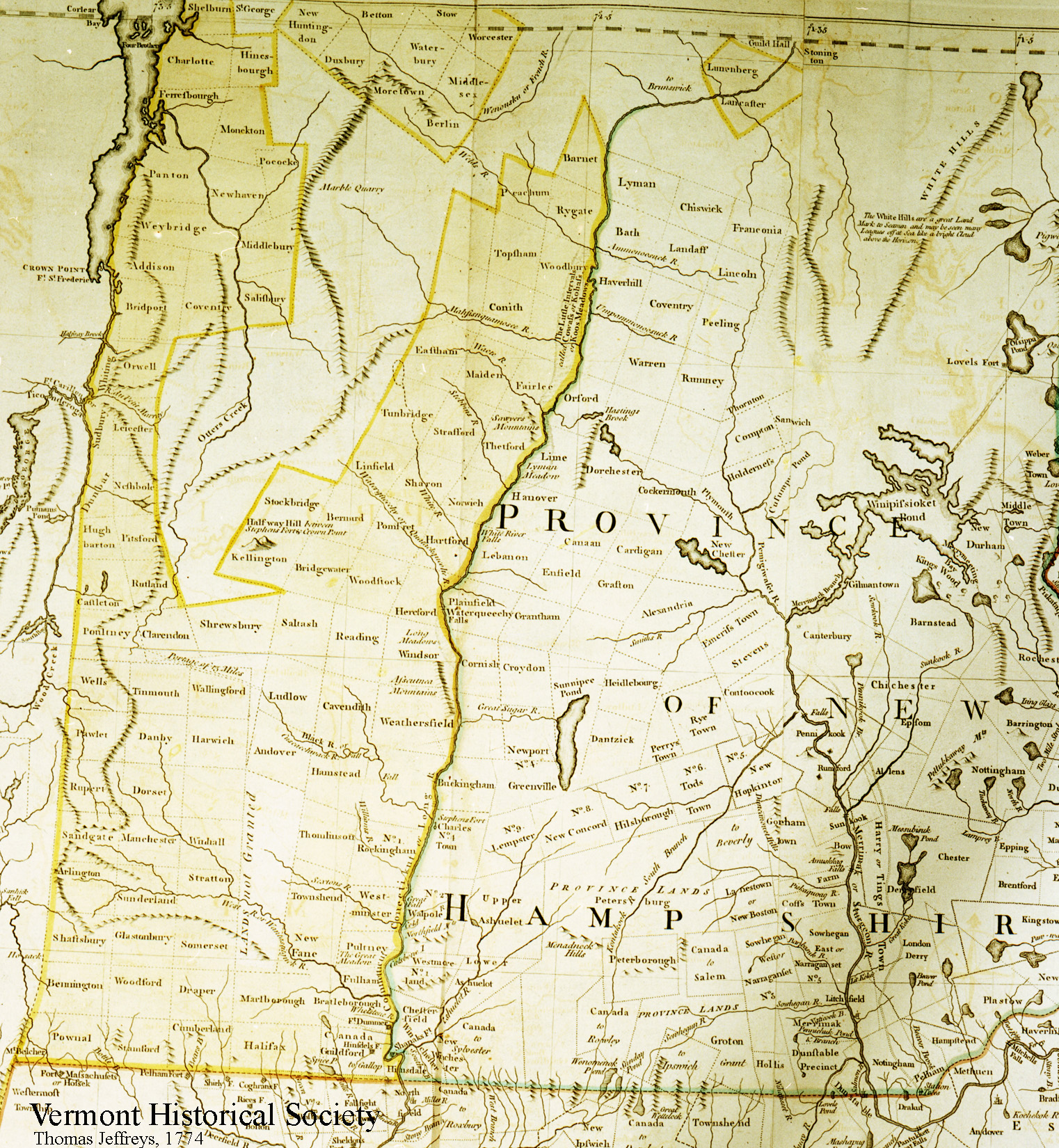
1774 Province of New Hampshire, Thomas Jeffreys
This map shows Vermont as part of the Province of New Hampshire with the towns chartered by New Hampshire. Is your town on this map?
Explore More: The New Hampshire Grants
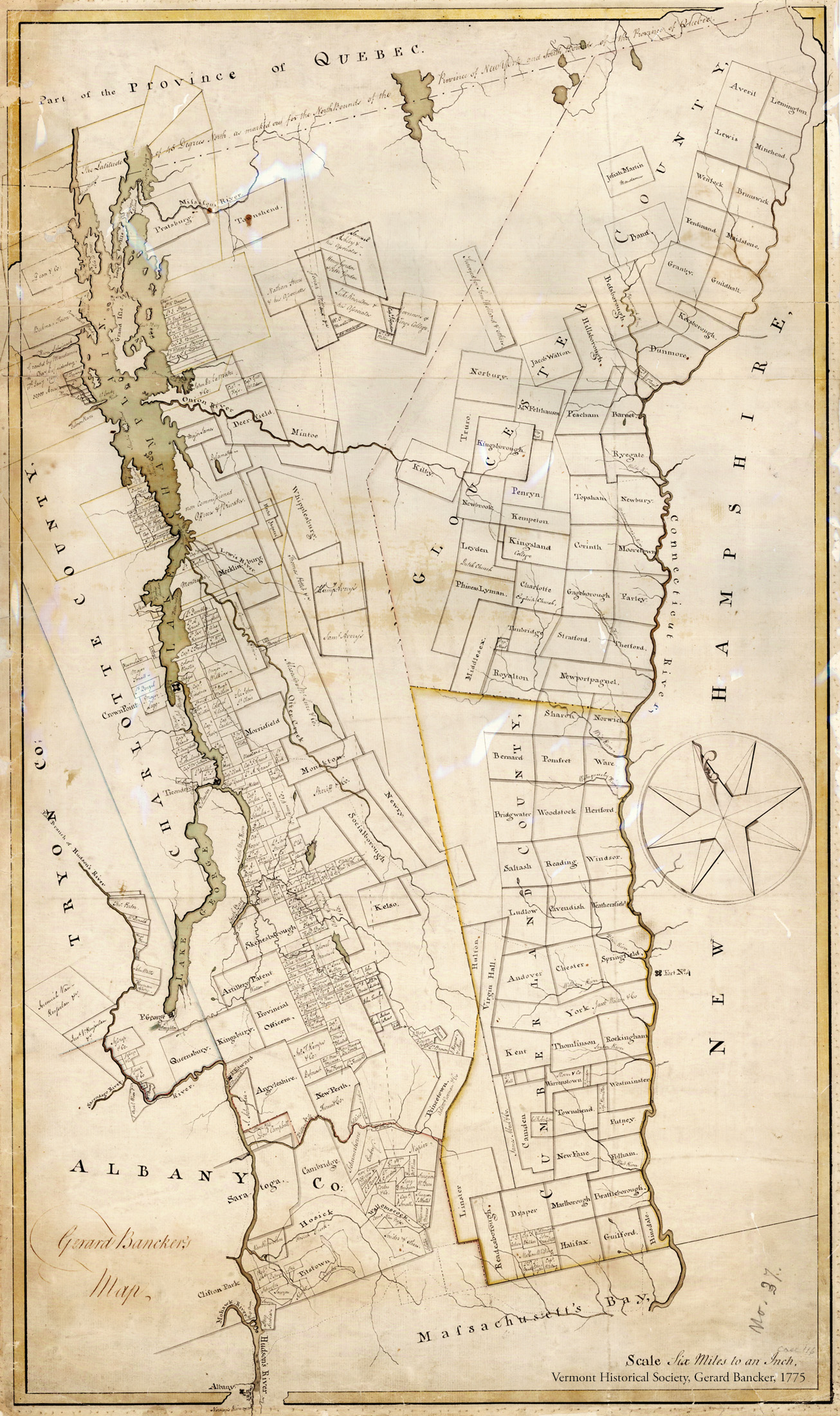
1775 New York Patents, Gerard Bancker
This map shows towns that were granted by New York. Can you find towns that no longer exist in Vermont?
Explore More: The New York Patents

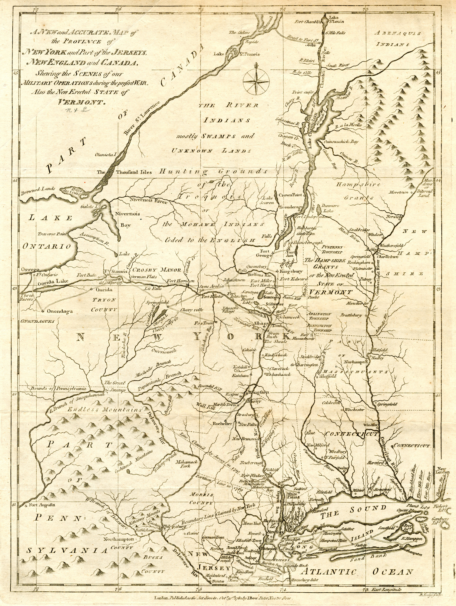
1780 New State of Vermont, John Bew
This corner of the map shows "The Hampshire Grants or the New Erected State of Vermont." How long had Vermont been independent when this map was printed?
Explore More: The Vermont Constitution
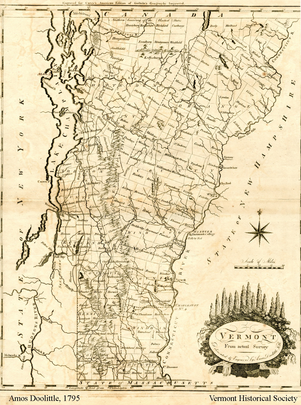
1795 Vermont map, Amos Doolittle
This map of Vermont was made a few years after Vermont became the 14th state. Can you find some towns that have changed their names since 1795?
Explore More: The 14th State
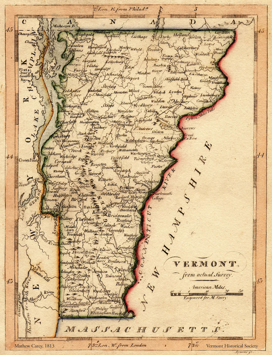
1813 Vermont map, Mathew Carey
This map from 1813 has details copied from older maps. The town of Minden changed its name to Craftsbury in 1790. And the town of Saltash changed its name to Plymouth in 1797. Why might historians look at maps that have incorrect information?
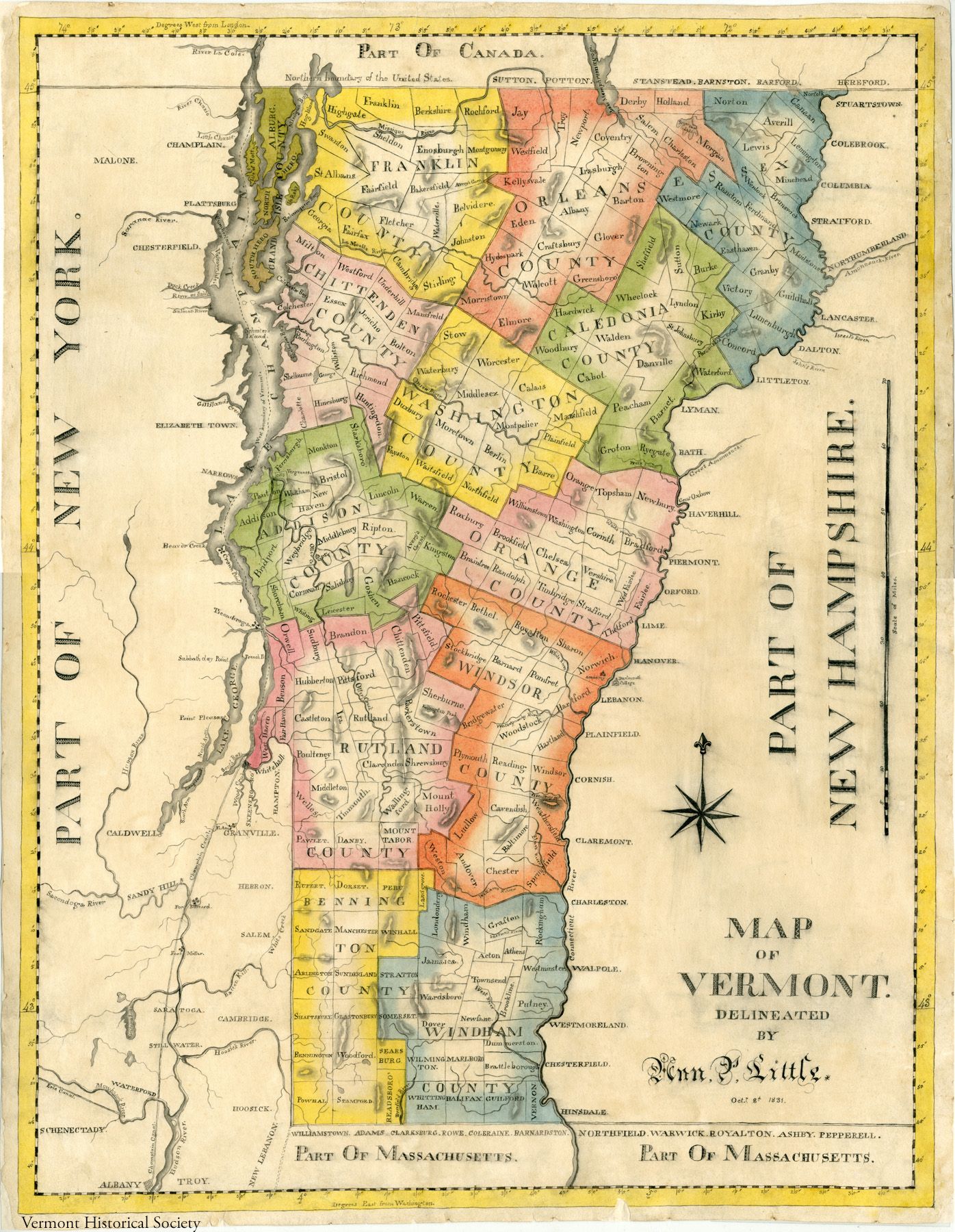
1831 Vermont map, Ann Little
Ann Little probably was a student when she drew this map in 1831. In the early 1800s, students learned geography and practiced penmanship by making maps.
This map has only 13 counties. Can you figure out which county was added after Ann Little made this in 1831?
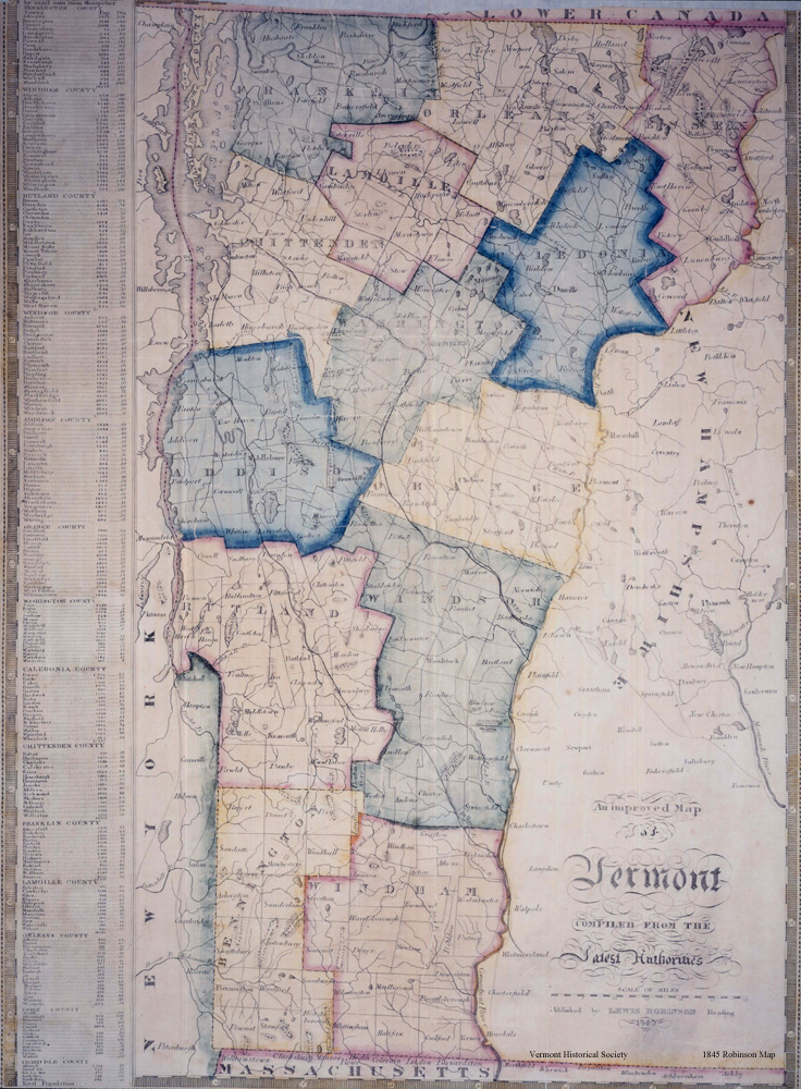
1845 Vermont map, Lewis Robinson
The title of this map is "An Improved Map of Vermont." What details does this map have that are not shown on earlier maps?

1878 Vermont map, from F.W. Beers Atlas of Lamoille and Orleans Counties
This map lists the names of villages and towns. The town of Randolph contains the villages of North Randolph, East Randolph, Randolph and West Randolph! What villages are shown for your town?
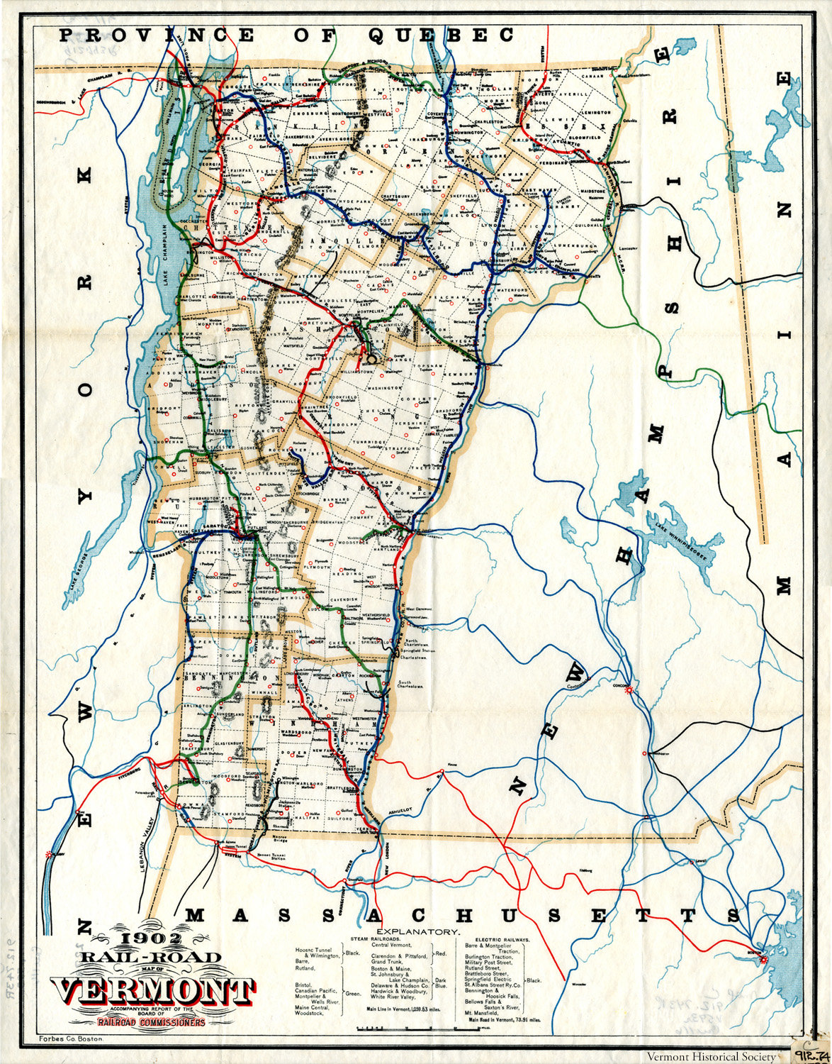
1902 Rail-Road Map of Vermont, Forbes Co.
By 1902, there were over 1,000 miles of train tracks in Vermont! Notice how some of the railroads are located near rivers. Why might river valleys be a good place to build train tracks?
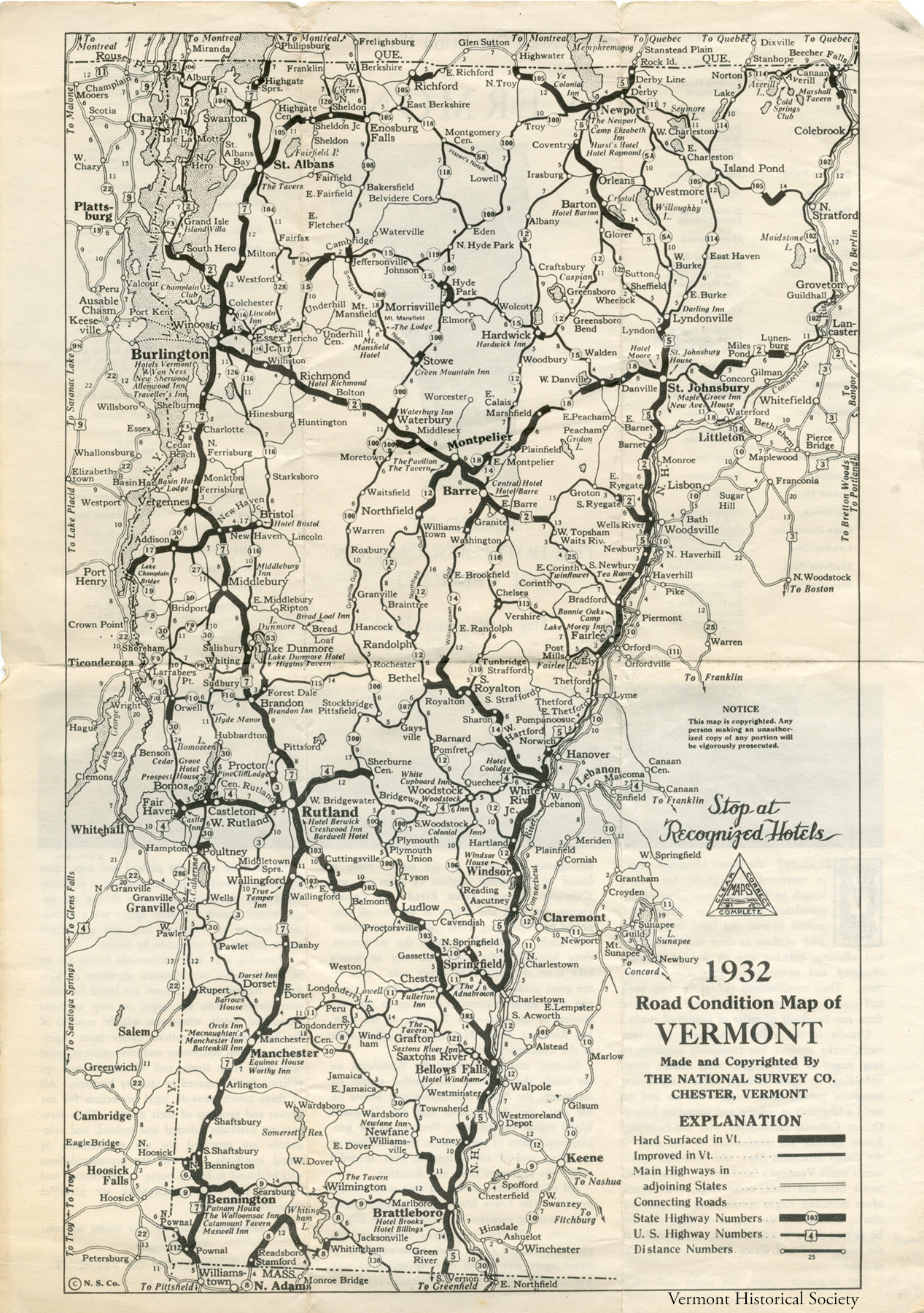
1932 Vermont map, The National Survey Company
Look at the key for this map. The map highlights hard surfaced (or paved) roads and improved (dirt) roads. Names of hotels are written in italics, like the Hotel Brooks and Hotel Billings in Brattleboro.
Who might want a map that shows hotels and good roads?

1942 Travelers Map of Vermont, Vermont State Planning Board
This map was made during World War II. It shows the bus routes in Vermont. Buses hold more people than cars. Traveling by bus instead of by car would save resources. During the war, supplies of gasoline and rubber tires were limited.
What towns could be reached by airplane in 1942?
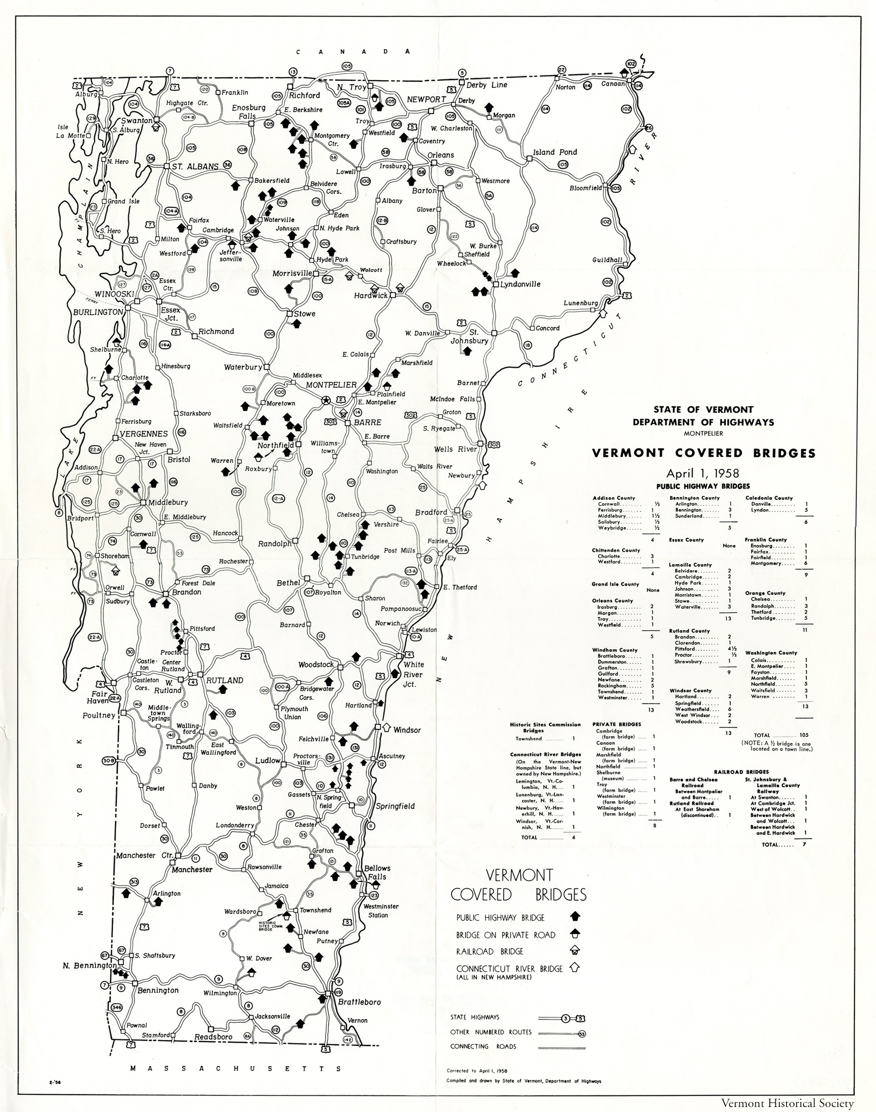
1958 Vermont Covered Bridges map, State of Vermont Department of Highways
In 1958, there were 125 covered bridges in the state. What towns could you visit to see the most covered bridges?
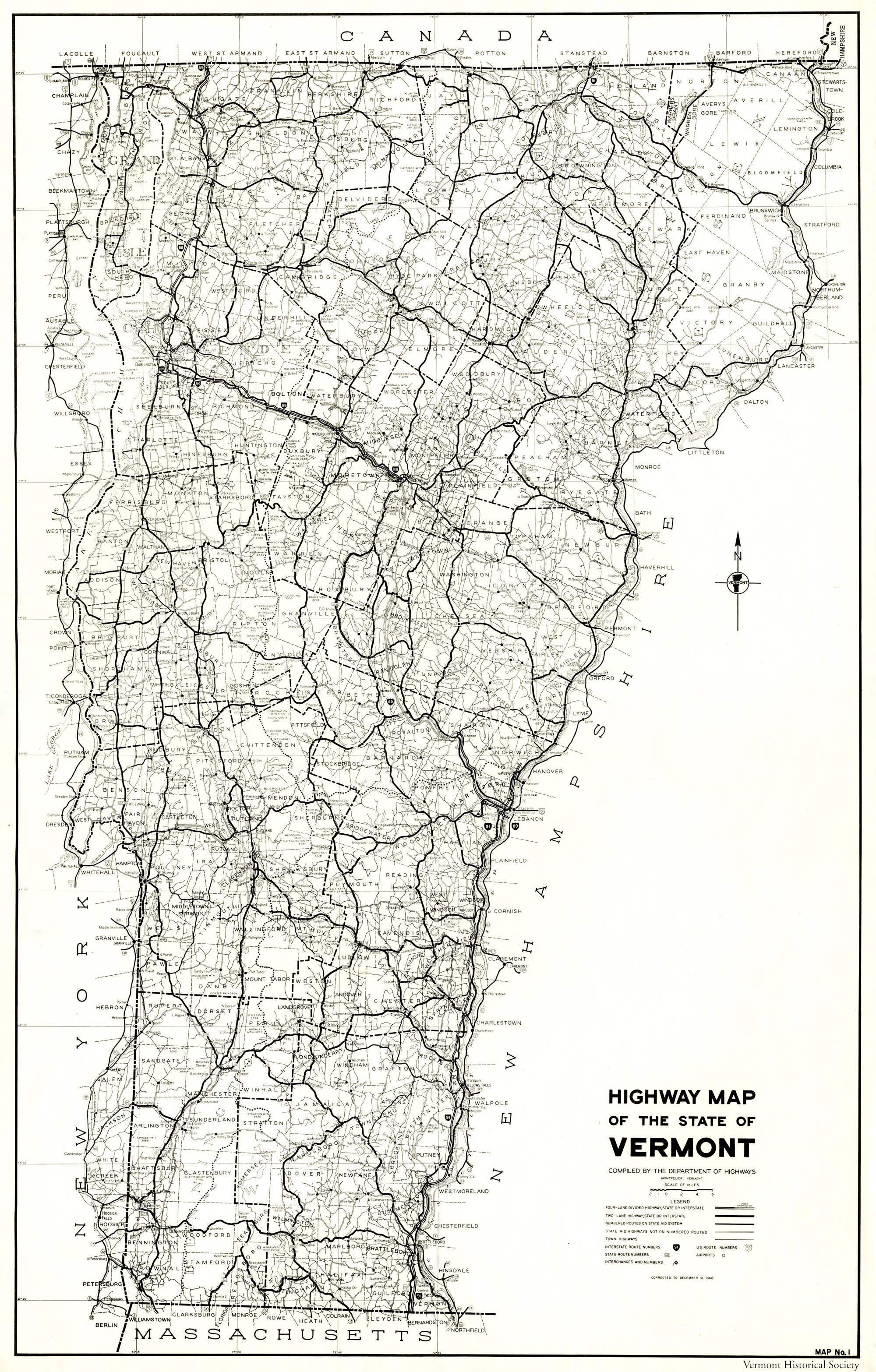
1968 Highway Map of the State of Vermont, Department of Highways
This map was made before the Interstate Highways were completed. The double lines show where Interstate 89 and Interstate 91 were finished. Can you find places where the interstates were still under construction? Look for the dotted double lines.