Vermont County Maps
What details can you find on county maps?

1857 Map of Addison County, Vermont, H. F. Walling
Zoom into the map at the Library of Congress. Can you find Hospital Creek in the town of Addison?
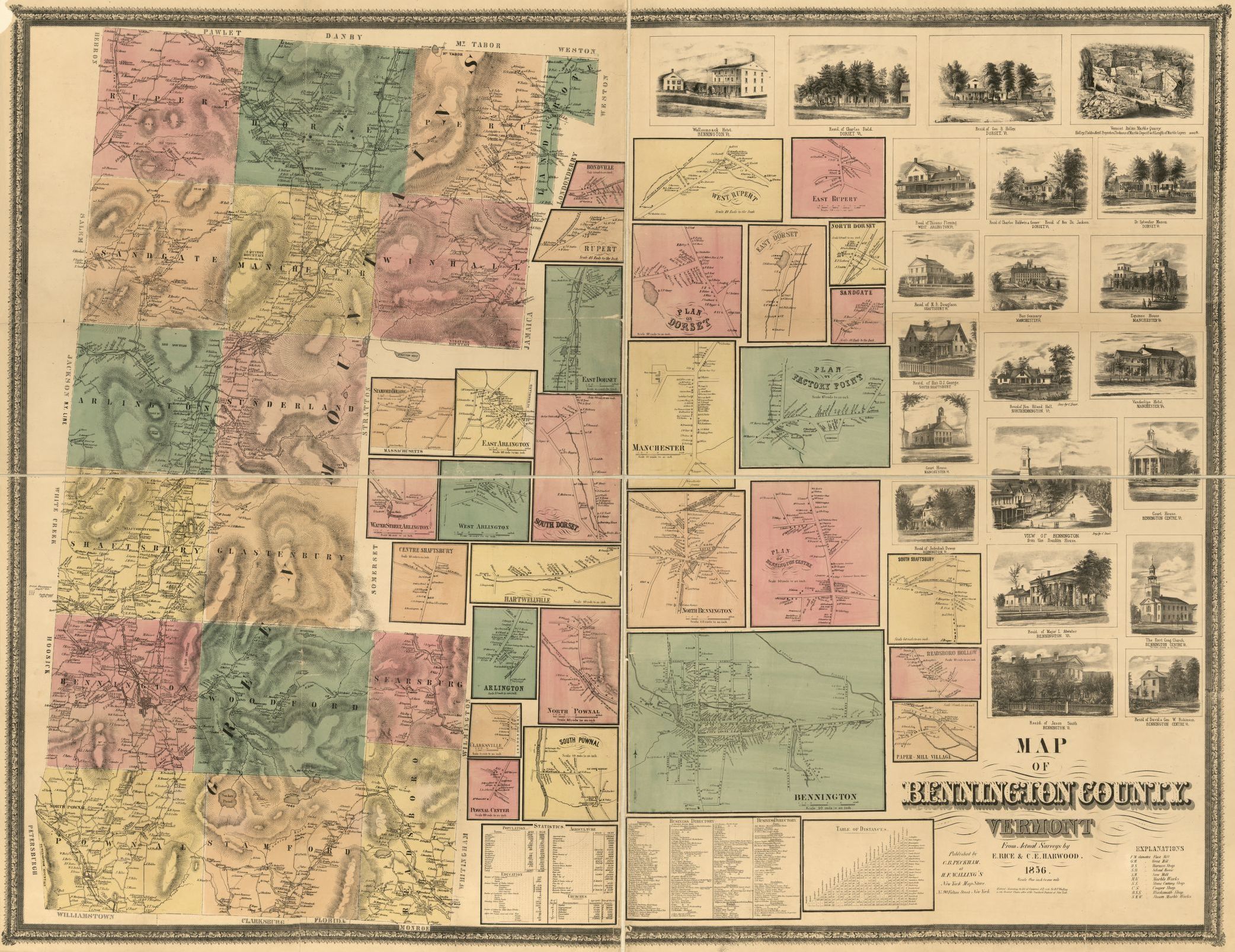
1856 Map of Bennington County, Vermont, C. B. Peckham
Zoom into the map at the Library of Congress. Bennington County is unusual because it has two shire towns, each with a Court House. Can you find which two towns are shire towns? Hint, look for the pictures of the Court Houses.

1858 Map of Caledonia County, Vermont, H. F. Walling
Zoom into the map at the Library of Congress. What river forms the eastern border of Caledonia County?
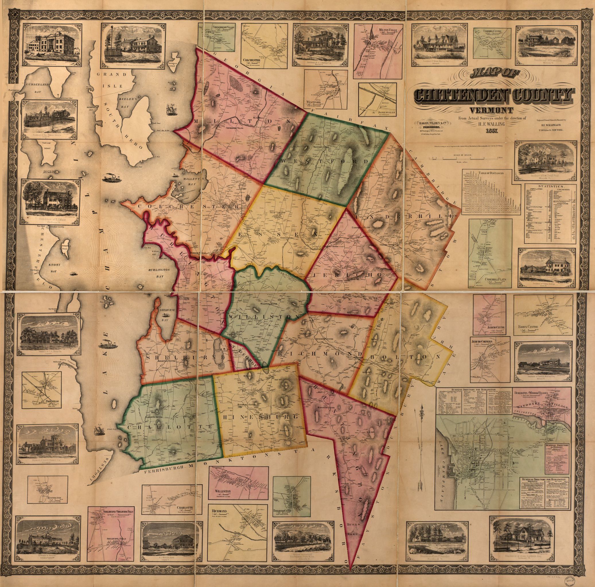
1857 Map of Chittenden County, Vermont, H. F. Walling
Zoom into the map at the Library of Congress. Can you find the Winooski Marble Company Quarries in the town of Colchester? Hint, the marble was probably transported on boats from Mallett's Bay.
Explore More: General Butler: The Man and the Boat (PDF)
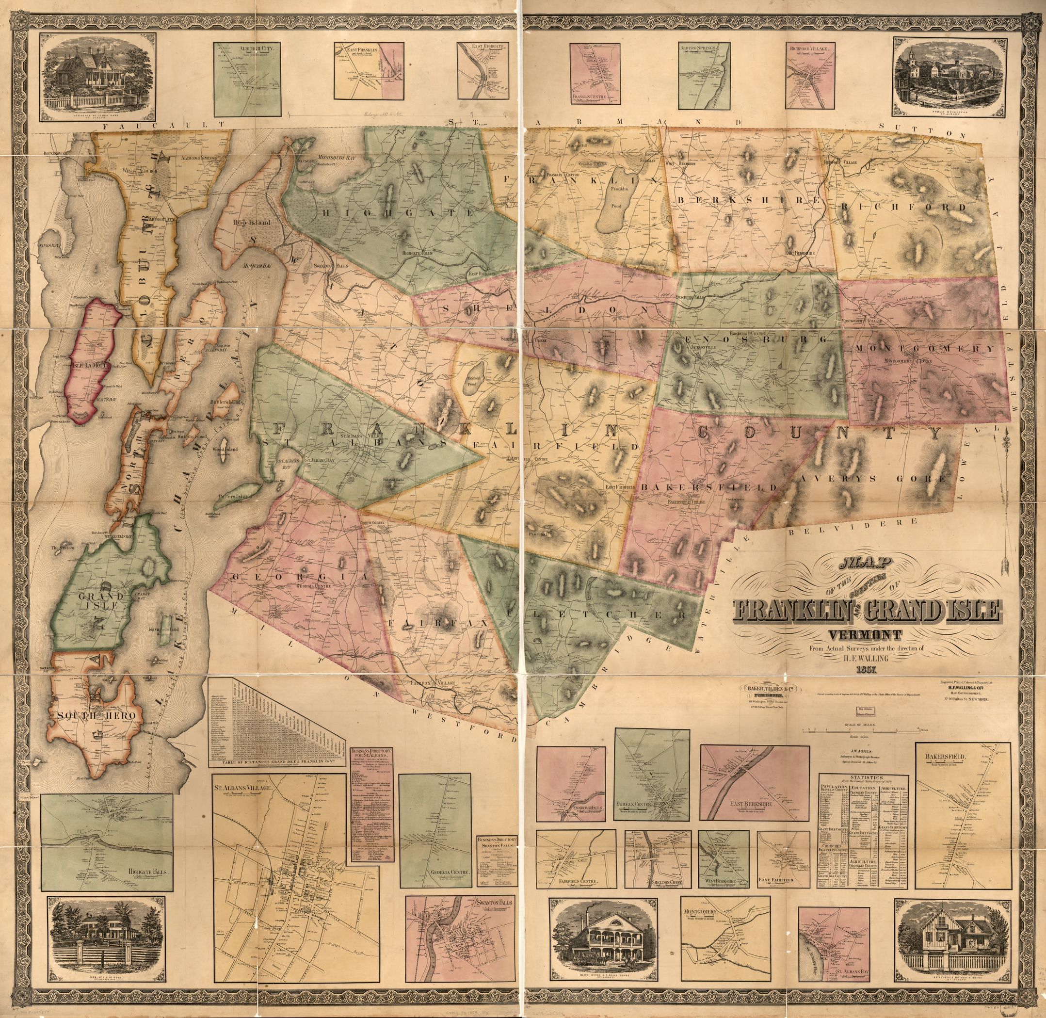
1857 Map of Franklin and Grand Isle Counties, Vermont, H. F. Walling
Zoom into the map at the Library of Congress. Trace the boundary between Franklin County and Grand Isle County. Which islands are part of Franklin County? Which islands are part of Grand Isle County?
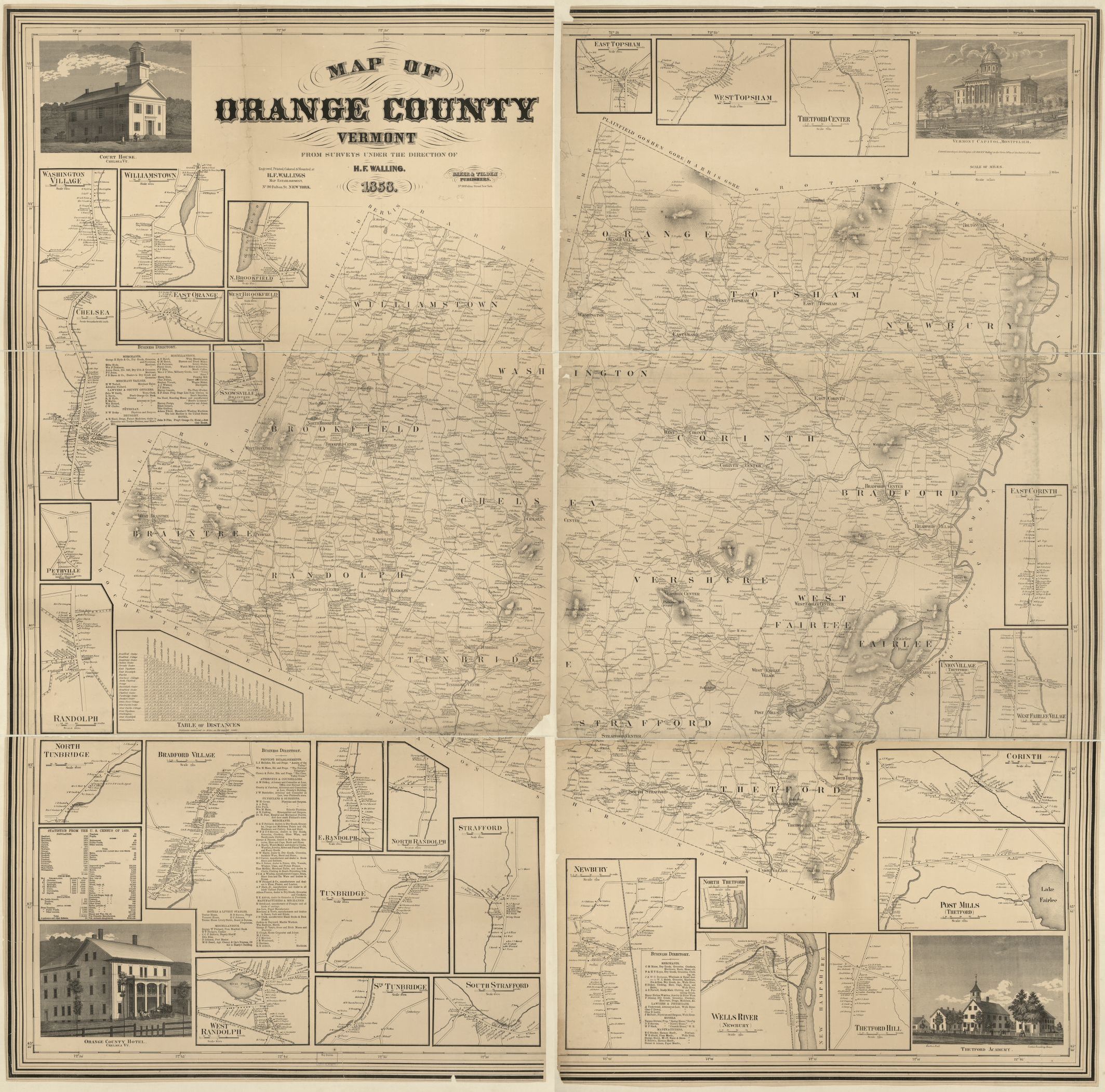
1858 Map of Orange County, Vermont, H. F. Walling
Zoom into the map at the Library of Congress. Can you find evidence of the floating bridge over Colt's Pond in the town of Brookfield?
Explore More: Brookfield Floating Bridge

1859 Map of Orleans, Lamoille and Essex Counties, Vermont, H. F. Walling
Zoom into the map at the Library of Congress. What is unusual about the towns of Ferdinand, Lewis, and Norton? Hint, why are they not listed on the Statistics from the Census of 1850?

1854 Map of Rutland County, Vermont, James D. Scott
Zoom into the map at the Library of Congress. Examine the shapes of the towns. Can you tell which town was created from parts of four other towns? Hint, it's in the middle of those four towns.
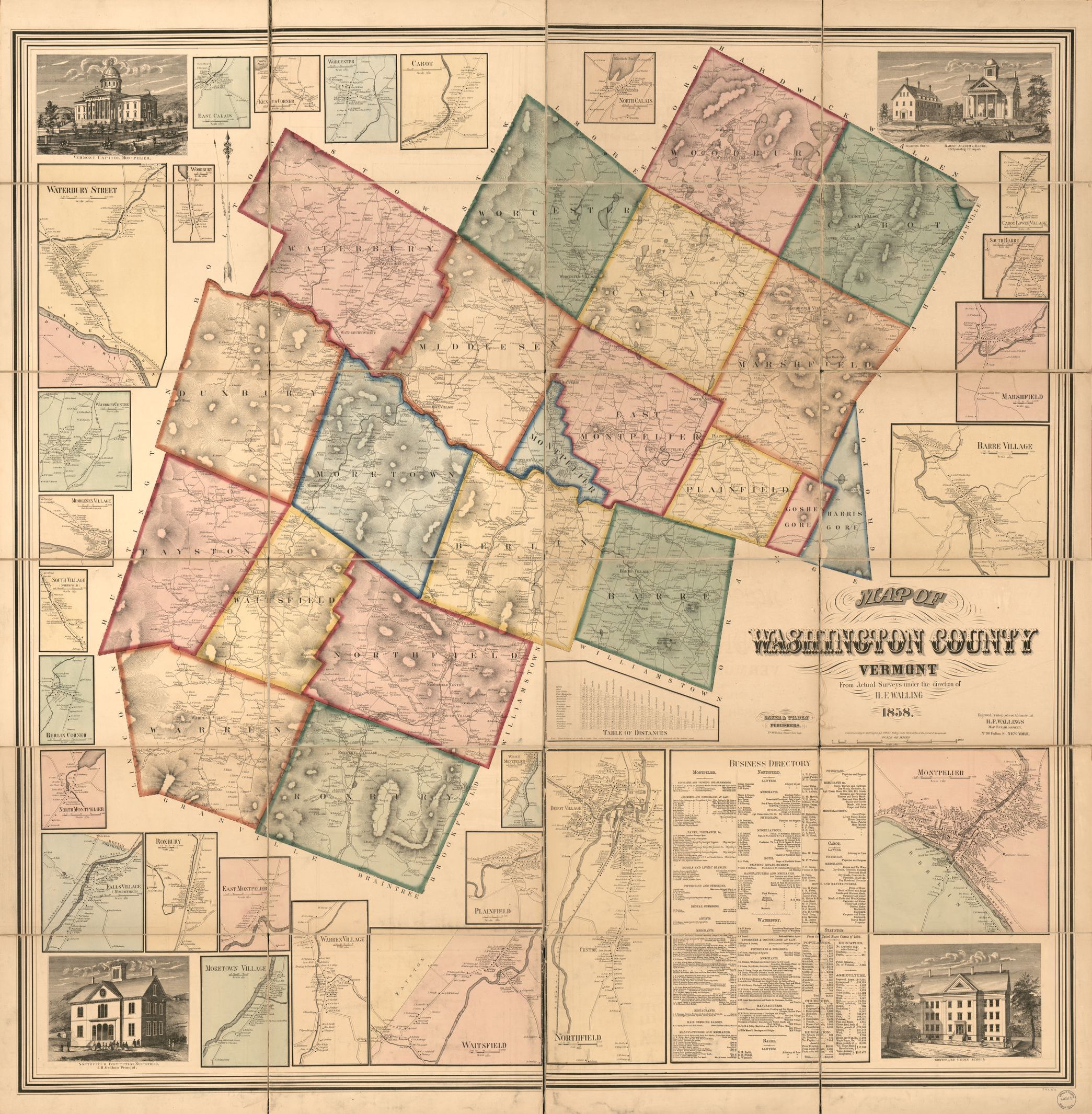
1858 Map of Washington County, Vermont, H. F. Walling
Zoom into the map at the Library of Congress. Look for the State House in the town of Montpelier. The drawing calls the State House the Vermont Capitol.
Explore More: The Vermont State House (PDF)
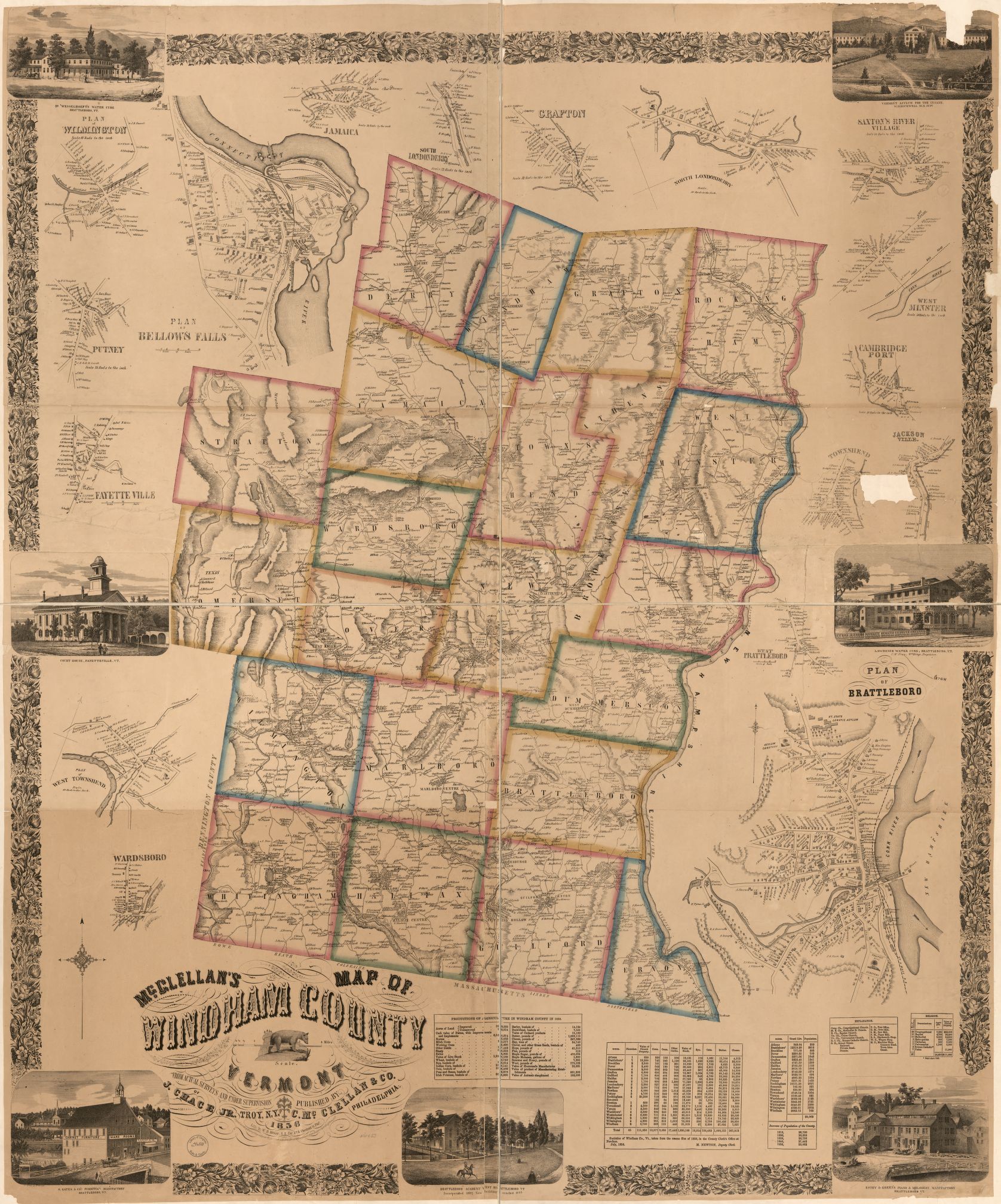
1856 Map of Windham County, Vermont, J. Chace, Jr & C. McClellan
Zoom into the map at the Library of Congress. Can you find how many pounds of butter were produced in Windham County in 1850?
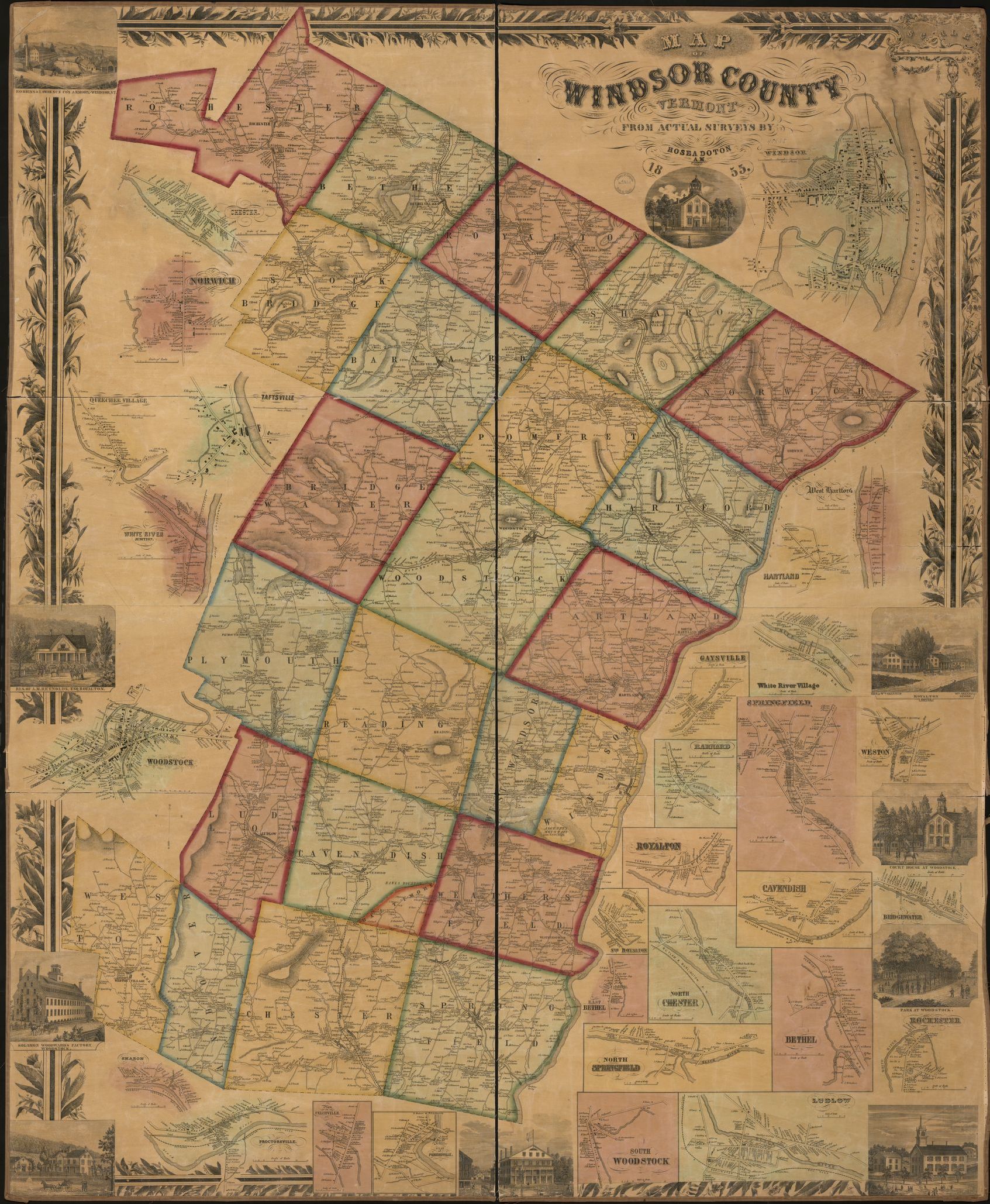
1855 Map of Windsor County, Vermont, Hosea Donton
Zoom into the map at the Library of Congress. How high is Ascutney Mountain in the town of Windsor?

1871 Map of Addison County, Vermont
Atlas of Addison County by F.W. Beers, 1871 (reprinted 1971)
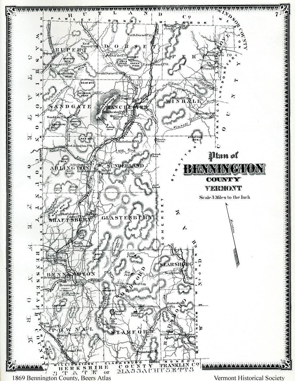
1869 Map of Bennington County, Vermont
Atlas of Bennington County by F.W. Beers, 1869 (reprinted 1969)

1875 Map of Caledonia County, Vermont
Atlas of Caledonia County by F.W. Beers, 1875
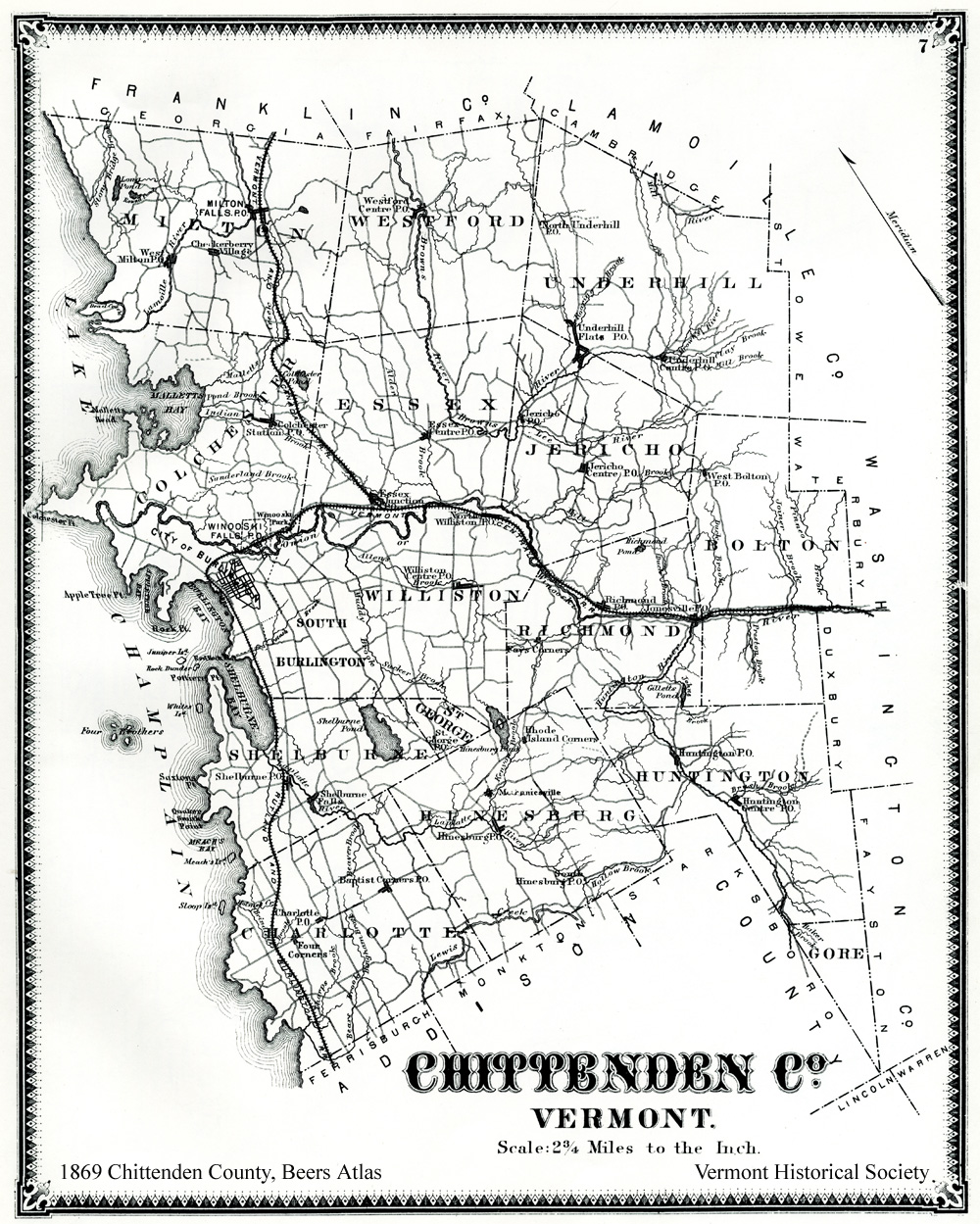
1869 Map of Chittenden County, Vermont
Atlas of Chittenden County by F.W. Beers, 1869 (reprinted 1971)
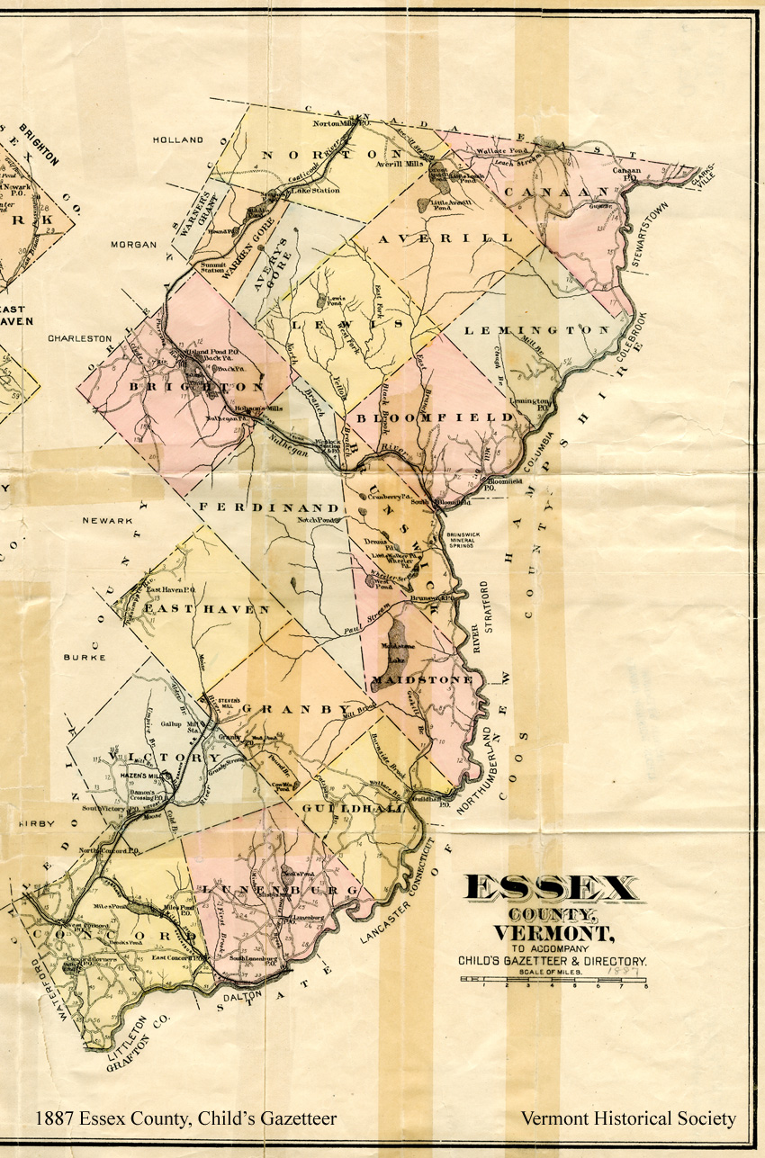
1887 Map of Essex County, Vermont
Gazetteer of Caledonia and Essex Counties, 1764-1887 by Hamilton Child
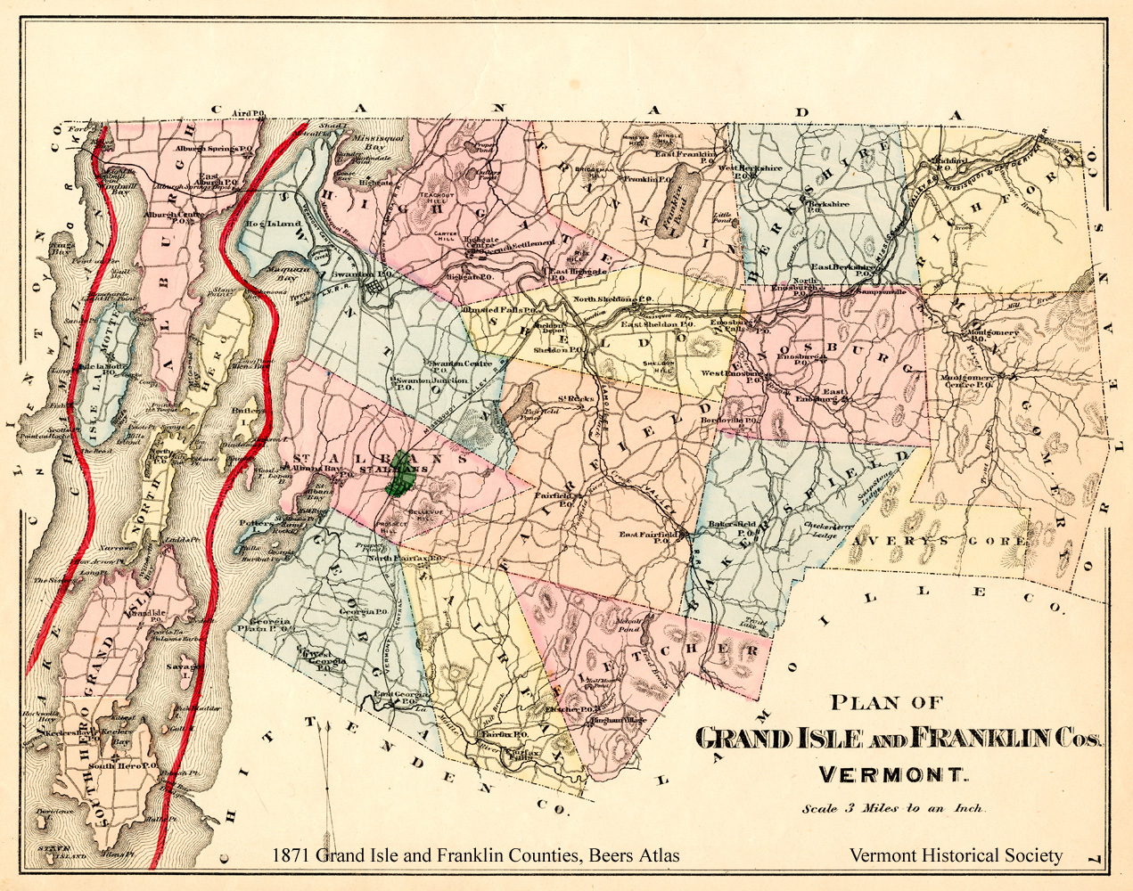
1871 Grand Isle and Franklin Counties, Vermont
Atlas of Grand Isle and Franklin Counties by F.W. Beers, 1871
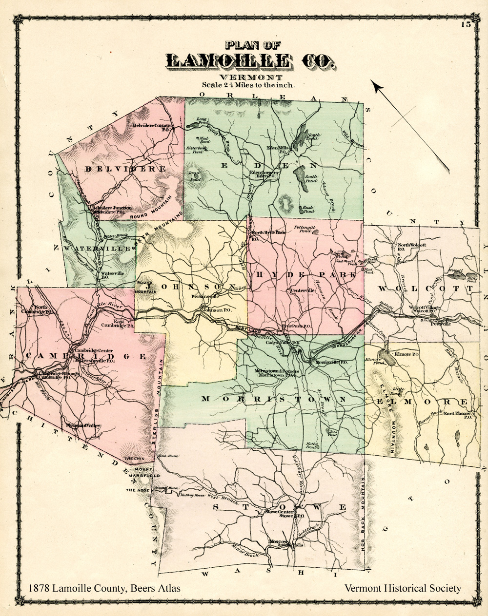
1878 Map of Lamoille County, Vermont
Atlas of Lamoille and Orleans Counties by F.W. Beers, 1878
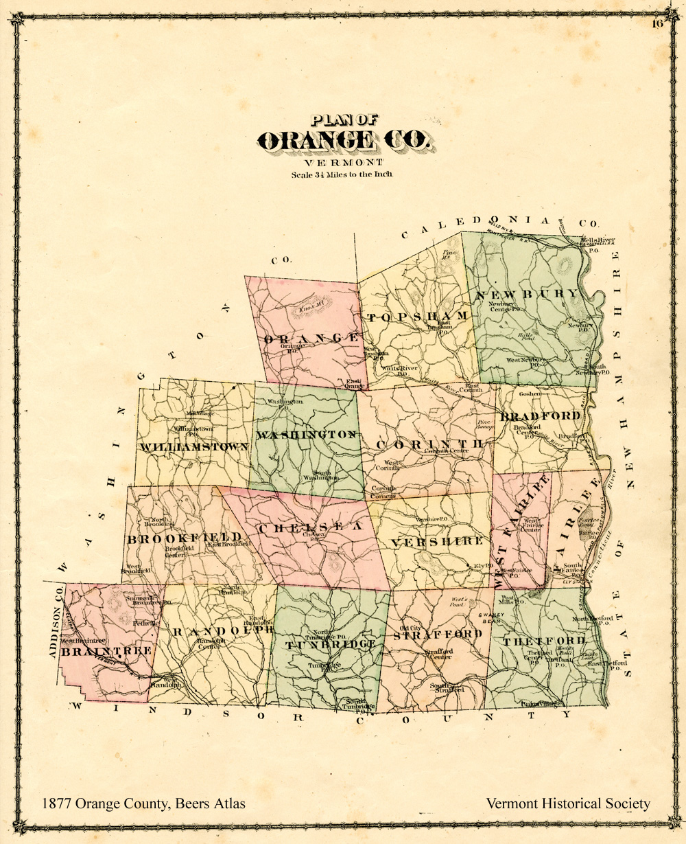
1877 Map of Orange County, Vermont
Atlas of Orange County by F.W. Beers, 1877
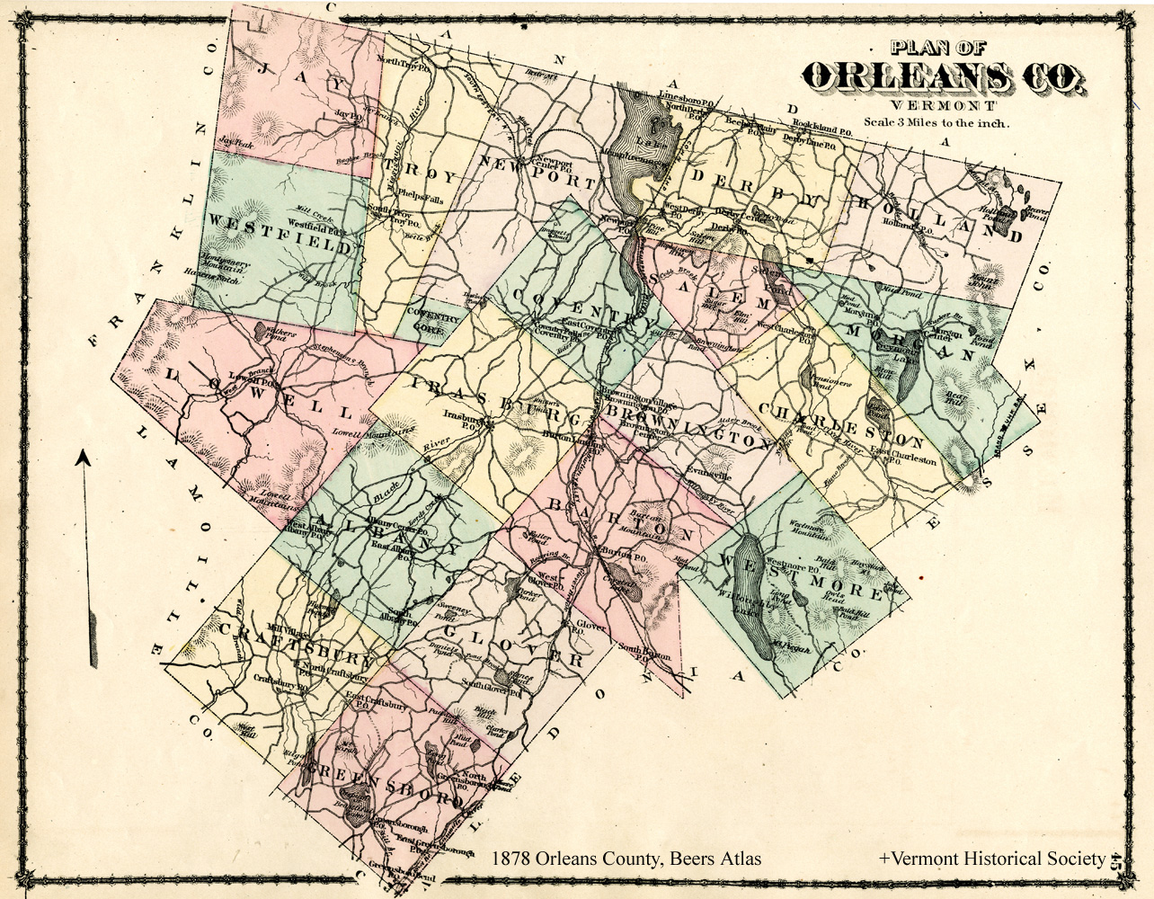
1878 Map of Orleans County, Vermont
Atlas of Lamoille and Orleans Counties by F.W. Beers, 1878
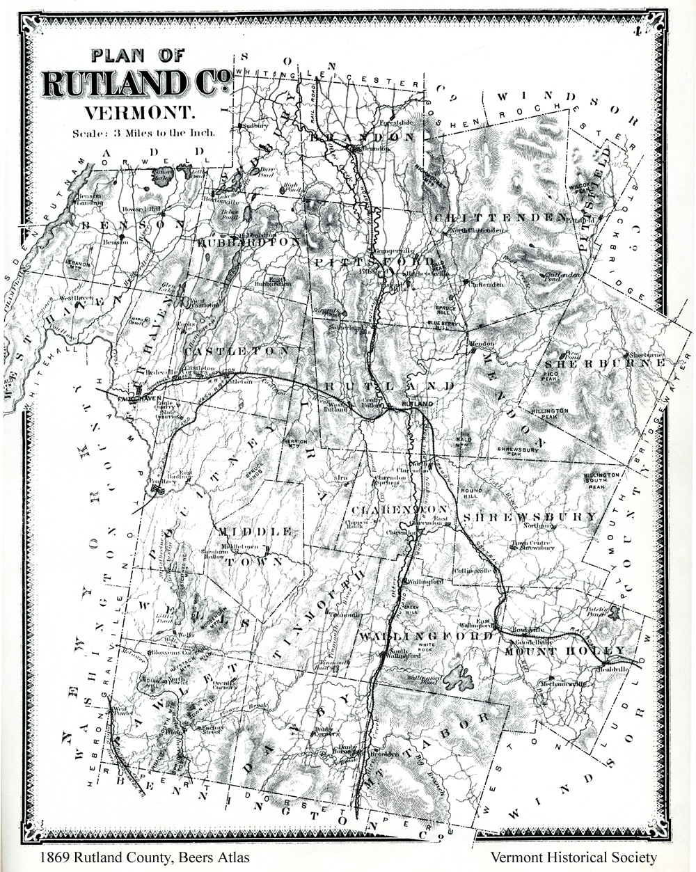
1869 Map of Rutland County, Vermont
Atlas of Rutland County by F.W. Beers, 1869 (reprinted 1969)
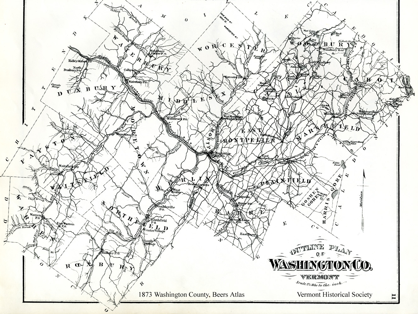
1873 Map of Washington County, Vermont
Atlas of Washington County by F.W. Beers, 1873 (reprinted 1971)
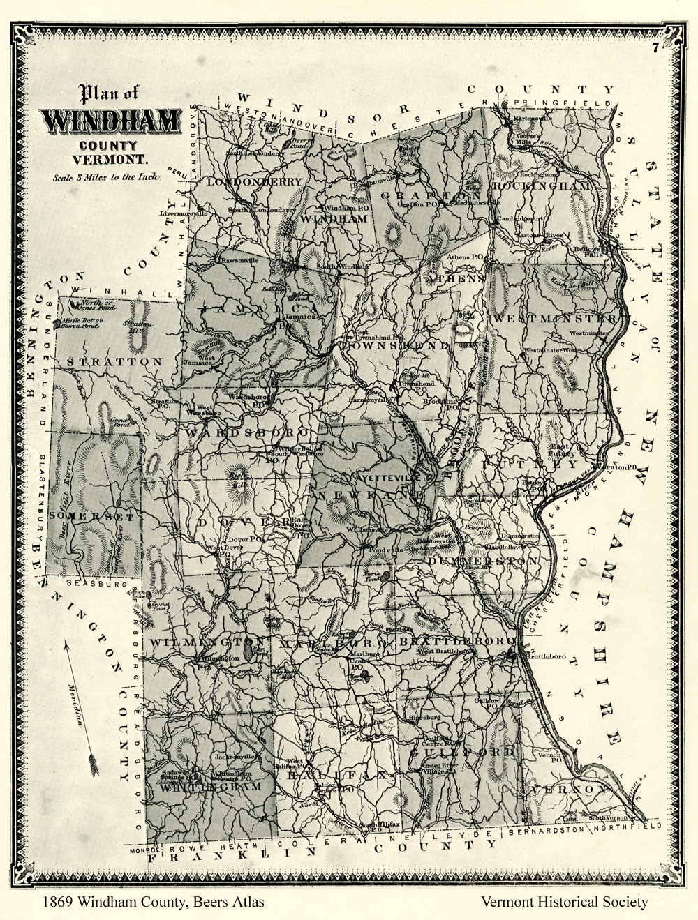
1869 Map of Windham County, Vermont
Atlas of Windham County by F.W. Beers, 1869 (reprinted 1969)
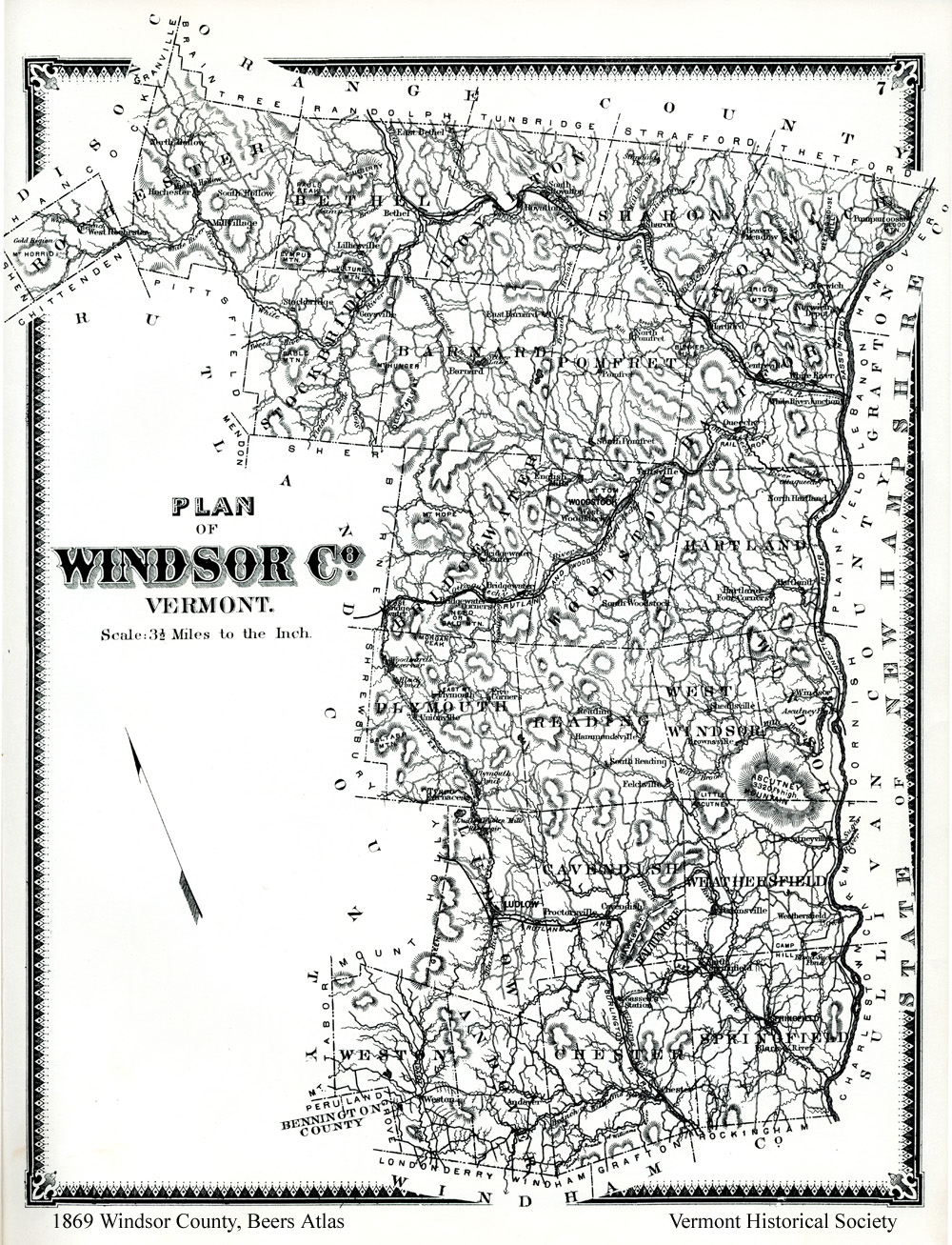
1869 Map of Windsor County, Vermont
Atlas of Windsor County by F.W. Beers, 1869 (reprinted 1969)