Other Vermont Maps
What is the purpose of these special Vermont maps?
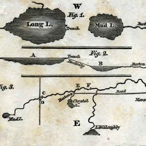
Sereno Edwards Dwight's map of Long Lake and Mud Lake, 1826
This map shows Long Lake or Long Pond. In Figure 2, Long Lake (A) is higher in elevation than Mud Lake(B). This is why the water flowed downhill and into the Barton River.
Explore More: Runaway Pond
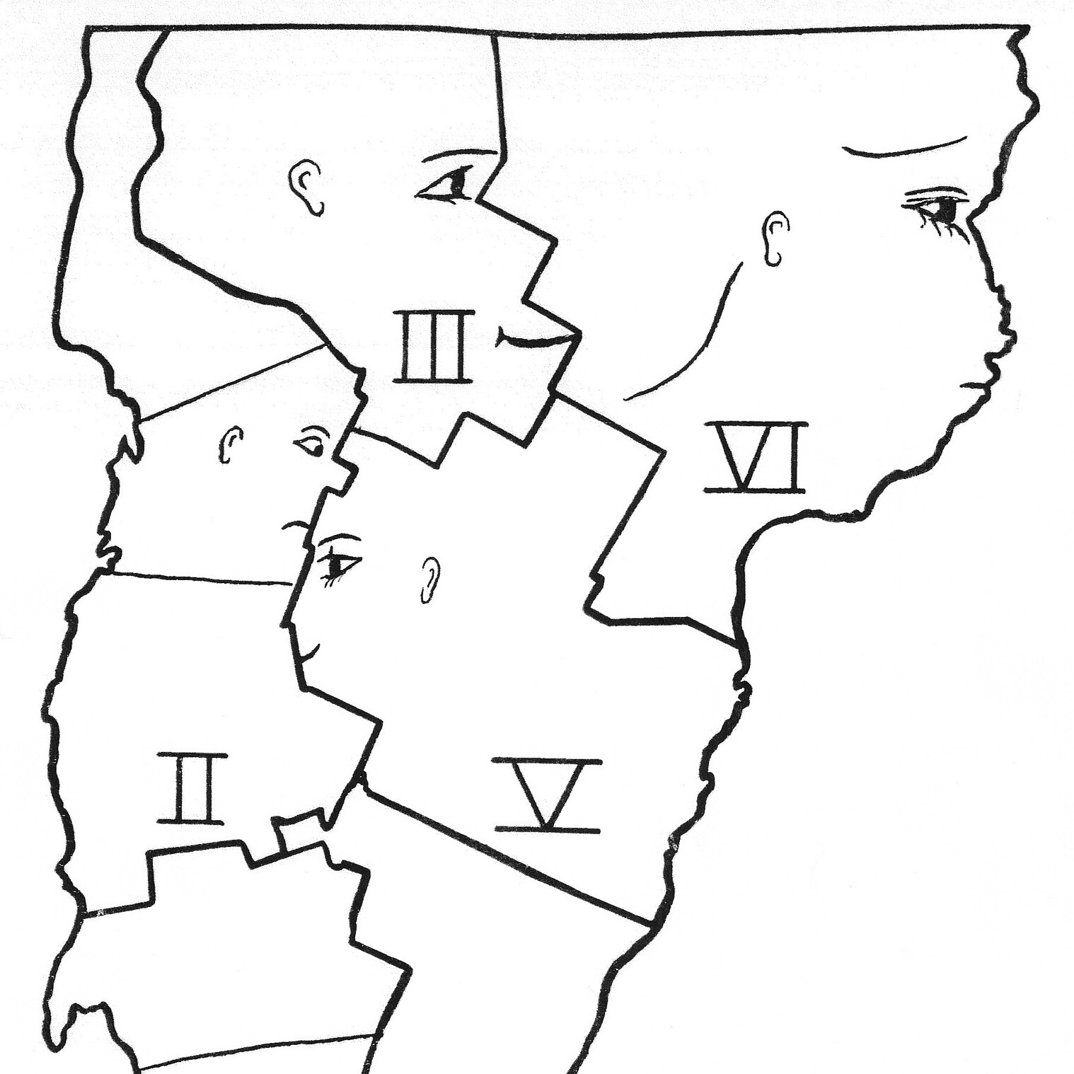
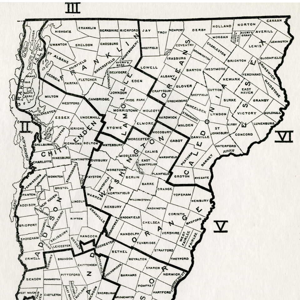
Mystery map, undated
Why are faces looking over Vermont? We do not know who drew this map. The numbers on the map are also a mystery. The outlines are not of Vermont counties. What do you think this map means?
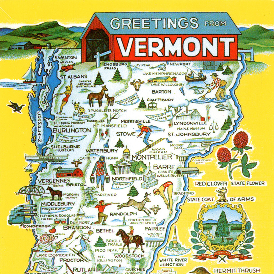
Greetings from Vermont postcard, undated
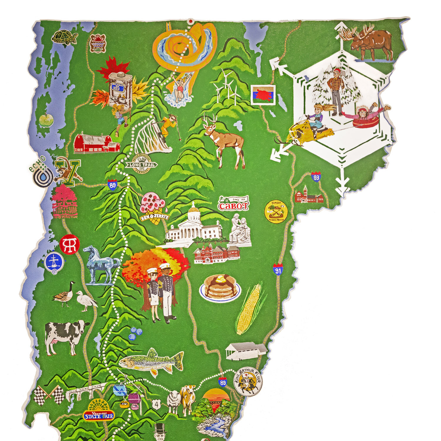
This postcard of Vermont highlights many industries in the state and shows activities that a tourist could do while on vacation.
The postcard is not dated, but clues suggest it is from the late 1950s. Both the Moore Dam on the Connecticut River and the Chester Arthur Birthplace were built in the mid-1950s.
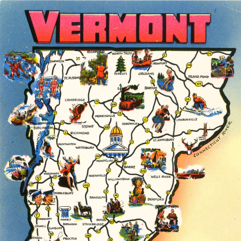
Vermont postcard, undated
Historians like to know the dates of maps. This postcard of Vermont is not dated. But the roads listed on the postcard might provide a clue.
The map shows main roads like Route 2 and Route 5. But it does not include the highways, like I-89 or I-91. The interstate was built between 1957 and 1982. So this postcard is probably from before 1957.
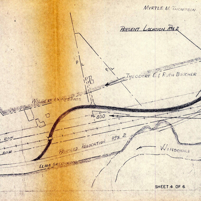
Proposed location of Interstate 89, 1950s
This map shows the plan to build the highway in Middlesex. Can you find the railroad tracks and Route 2 near the Winooski River? The Department of Highways moved Route 2 to make room for the new interstate highway. Have any roads been moved in your town?
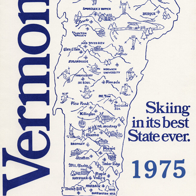
Vermont ski areas, 1975
The purpose of this map is to show the ski areas in Vermont in 1975. Historians can use this to understand how skiing in Vermont has changed over time. What would a current map of Vermont ski areas look like?
Explore More: Small Beginnings: The First Rope Tow in Vermont (PDF)
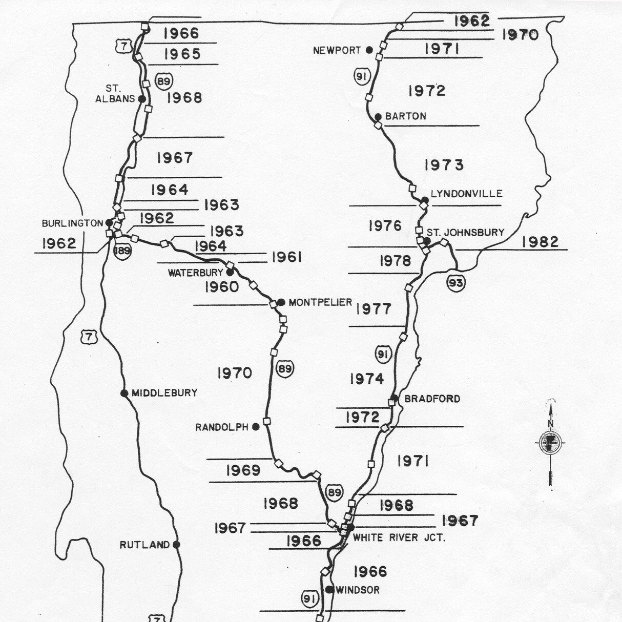
Vermont Interstate Map, undated
Did you know it took over 25 years to build the interstate highways in Vermont? This map tells us when sections of the highway were completed. Why do you think the interstate construction was started in southern Vermont?
Explore More: Getting Around (PDF)
